Buffer Area
The Buffer Area tool allows users to create an outline along selected roads to define a specific area within the map.
Users can create either an open outline that follows the selected roads or a closed loop that connects the beginning and end of the selected road sequence to create an enclosed area.
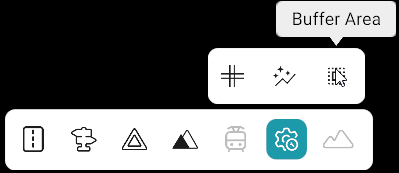
Note
The Buffer Area tool is available under Advanced Tools: Bottom Toolbar → Advanced Tools → Buffer Area
How to Use the Buffer Area Tool
- Open Advanced Tools from the bottom toolbar.
- Select Buffer Area from the sub-toolbar.
- In the Buffer Area panel, click Create New Outline.
- Set the Closed Loop toggle as required.
- Left-click the required roads in sequence, selecting them anti-clockwise.
- Click Complete to finish the outline.
- Repeat the road-selection process to create another buffer area.
- Click Stop Creation when finished.
Closed Loop
The Closed Loop toggle determines whether the outline remains open or forms an enclosed area.
| Closed Loop | Behavior |
|---|---|
| ON | Connects the start of the first selected road to the end of the last selected road and fills the enclosed area. |
| OFF | Creates an open outline that follows only the selected roads. |
Buffer Area Panel
| Option | Description |
|---|---|
| Buffer Area Dropdown | Displays and highlights the selected buffer area. |
| Show All Outlines | Displays all created buffer area outlines. |
| Closed Loop | Controls whether the outline is open or closed. |
| Complete | Completes the current buffer area outline. |
| Stop Creation | Stops the buffer area creation process. |
| Delete Selected Outline | Deletes the selected buffer area. |
Buffer Area Display
| Buffer Area Status | Display |
|---|---|
| Selected Buffer Area | Dark green |
| Other Buffer Areas | Sea green |