Export Map
The Export Map workflow allows users to generate map files in different formats based on project requirements. Users can export the complete map or create format-specific variants optimized for external tools and simulation platforms.
How to Export the Map (XODR)
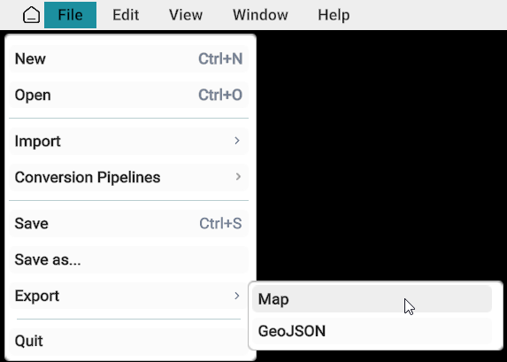
- Go to File menu from the top menu bar.
- Select Export from the drop-down menu.
- Click Map.
- The Export Map window will appear.
Export File Types
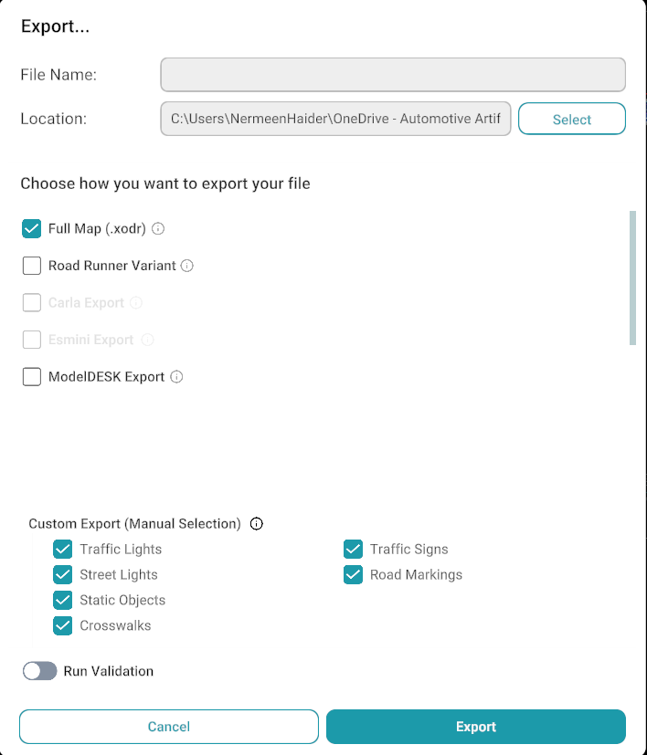
The following export formats are available:
- Full Map
- Road Runner
- ModelDESK
- CARLA (Currently Unavailable)
- Esmini (Currently Unavailable)
Export file types screenshot
Full Map
The Full Map export generates the complete map without applying any modifications or filtering. This export preserves the map exactly as it exists in the project.
| Primary Roads | Connecting Roads | Junctions |
| Traffic Signs | Traffic Lights | 3D Objects |
| Repeatable Objects | Trees and Vegetation | Road Markings |
| All Map Assets and Metadata |
Exports: The Items/ elements selected from "Custom Export"
Road Runner
The Road Runner export generates a map compatible with Road Runner workflows. This export is intended for users who require a simplified map for Road Runner environments.
Exports: The Items/ elemenets selected from "Custom Export"
ModelDESK
The ModelDESK export generates a ModelDESK-compatible map variant. During export, the map is processed to remove unsupported elements and improve road connectivity.
Exports: The Items/ elemenets selected from "Custom Export"
Additional Processing:
- Non-drivable roads are removed.
- Connecting roads are converted to primary roads when the lane count matches.
- Connecting roads remain unchanged when lane counts do not match.
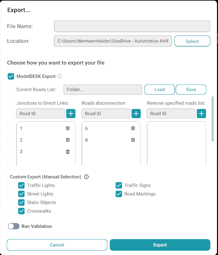
ModelDESK export screenshot
ModelDESK Tools
Current Roads List
The Current Roads List allows users to manage roads that require attention before export.
Users can:
- Upload a list of road IDs.
- Maintain a list of problematic roads.
- Save road IDs for future use.
| Option | Description |
|---|---|
| Junction to Direct Links | Add the IDs of drivable roads whose connecting roads have connectivity or offset issues. The specified roads are processed during export to correct the associated connecting road connections |
| Roads Disconnection | Add the IDs of problematic non-drivable roads, such as shoulder roads, sidewalks, or other non-drivable road types. These roads are treated as disconnected during export processing. |
| Remove Specified Roads List | Add road IDs that cannot be corrected through standard methods. These roads are removed from the generated ModelDESK map during export. |
Load / Save
| Option | Description |
|---|---|
| Load | Load a previously saved JSON file containing road IDs and export configuration data. |
| Save | Save the current road IDs and export configuration data to a JSON file for future use. |
Custom Export
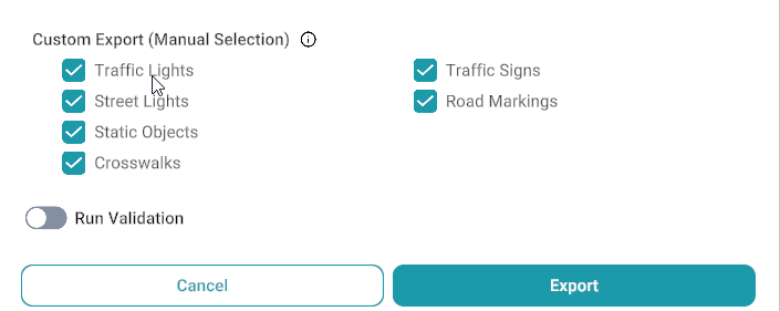
The Custom Export option provides complete control over the export content. Users can manually select which map components should be included in the exported file.
- Displays a checklist of all exportable map elements.
- Allows selection of the required items for export.
- Only items present in the current map are enabled and selectable.
- Items that do not exist in the map are displayed as disabled (greyed out) and cannot be selected.
Custom export screenshot
Related
- Main screen overview — File menu and export access from the editor.
- Export XODR to GeoJSON — convert exported XODR maps to GeoJSON (coming soon).
- Validator — validate maps before export.