Junction / Elevation Grid
The Elevation Grid is used to define and manage elevation information around road junctions. It creates a grid based on the junction outline and allows elevation data to be recalculated when road geometry or elevation is changed.
How to Use
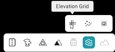
- Click Advanced Tool from the toolbar.
- Select Junction / Elevation Grid from the sub-toolbar.
- All junctions on the map will be listed in the Junctions panel.
- Search for the required junction using its Junction ID or select it from the list.
- If a junction already has a grid, it will show Outline; otherwise, it will show No Outline.
- Select the required junction and click Draw Outline.
- Draw the junction outline anti-clockwise.
- Click Close Outline after completing the selection.
- Select the required grid size and smoothening value.
- Click Save.
Junction Outline Creation
The junction outline must be created in an anti-clockwise direction.
| Action | Description |
|---|---|
| Left Click | Draw a yellow line along the road/lane. |
| Shift + Left Click | Select a patch. |
| Right Click | Draw a red line across the road. |
| Shift + Right Click | Draw a red line across all lanes. |
| Ctrl + Shift + Right Click | Draw a red line across a single lane. |
Grid Management
The following actions are available for managing junction grids:
| Action | Description |
|---|---|
| Recalculate All Grids | Recalculates all grids after road or elevation changes. This should be performed before exporting the map when road data has been modified. |
| Delete All Outlines | Deletes all created junction grids. |
| Show All Outlines | Displays all existing junction grids on the map. This is enabled by default. |
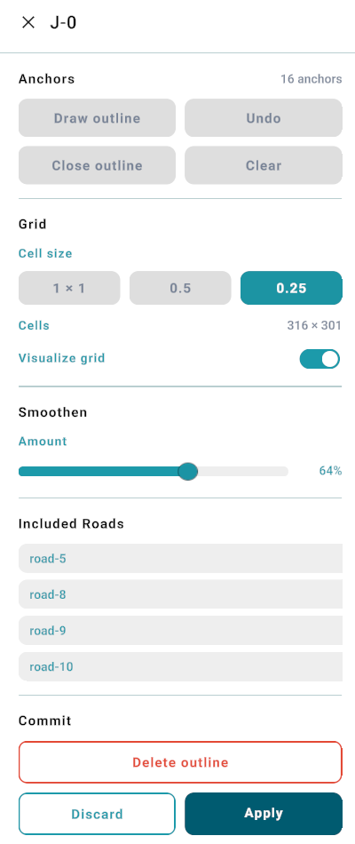
Junction / Elevation Grid Detail Panel
| Section / Element | Description |
|---|---|
| Junction ID (J-0) | Displays the ID of the selected junction. |
| Anchors | Displays the anchors used to define the junction outline. |
| Draw outline | Starts the process of creating the junction outline. |
| Undo | Removes the most recent outline or anchor action. |
| Close outline | Completes and closes the junction outline. |
| Clear | Clears the current outline and selected anchors. |
| Grid | Contains the grid configuration options for the junction. |
| Cell size | Allows the user to select the grid cell size from the available options: 1 × 1, 0.5, and 0.25. |
| Cells – 22 × 21 | Displays the number of cells generated for the current grid. |
| Visualize grid | Shows or hides the generated grid on the map. |
| Smoothen | Allows the user to adjust the smoothening level of the elevation grid using the slider. |
| Included Roads | Lists the roads included in the junction grid. |
| Delete outline | Deletes the existing junction outline. |
| Discard | Discards the current changes without applying them. |
| Apply | Applies and saves the current junction grid changes. |
Junction / Elevation Grid detail panel screenshot
Notes
- Junction outlines must always be created in an anti-clockwise direction.