Road Properties Panel
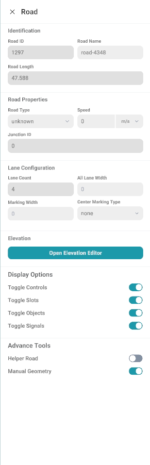
When you single-click a road with the left mouse button, the corresponding Road Properties panel opens on the right side of the canvas.
Road Properties panel screenshot
Sections in the Panel
Identification
| Field |
Purpose |
| Road ID |
Unique system ID for the road (read-only). |
| Road Name |
Editable name of the road. |
| Road Length |
Total length of the road (read-only, updates automatically). |
Road Properties
| Field |
Purpose |
| Road type |
Category for the road (for example motorway vs urban). |
| Speed |
Design or legal speed with a unit (for example m/s or km/h—check the dropdown). |
| Junction ID |
Associates the road with a junction when applicable (-1 or empty often means “no junction”). |
Lane Configuration
| Field |
Purpose |
| Lane count |
Number of lanes on this road (road-level default; you can still refine per lane later). |
| All lane width |
A uniform width applied across lanes when using this shortcut (use 0 or leave default if you set width per lane elsewhere). |
| Marking width |
Width used for painted markings (centre line, lane separators) where the product applies it at road level. |
| Center marking type |
Style of the centre marking between opposing directions (for example none, solid, dashed). |
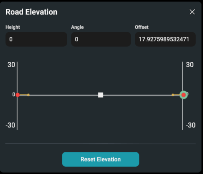
Elevation
| Opens the elevation editor for the road’s vertical profile. This is used to define and adjust road heights and slopes, and to align the road with elevation or design requirements. |
Road Elevation editor screenshot
Display Options
It controls what is shown for the selected road in the editor. They only affect visibility and do not change or delete any data.
| Field |
Purpose |
| Toggle Controls |
Show or hide edit handles and control points on the canvas. |
| Toggle Slots |
Show or hide lane slots and connection points used for linking roads and lanes. |
| Toggle Objects |
Show or hide objects placed on the road. |
| Toggle Signals |
Show or hide signals such as traffic signs and lights. |
| Field |
Purpose |
| Helper road |
An extra support path used while creating or editing a main path or shape. It helps guide the process but is not part of the final result. |
| Manual geometry |
Lets you directly control and shape the path yourself instead of the system automatically adjusting it. |